
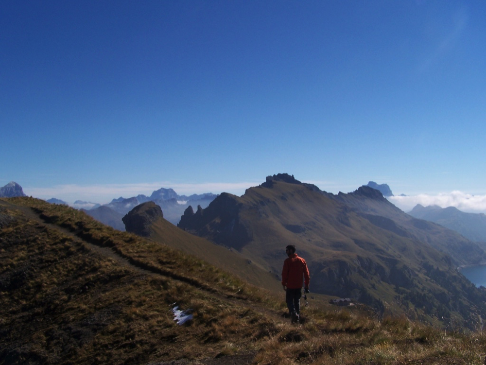
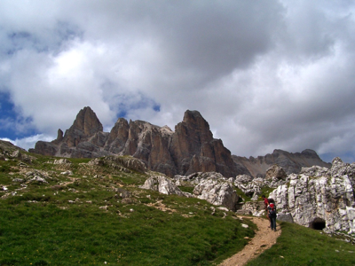
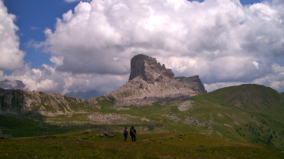
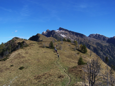
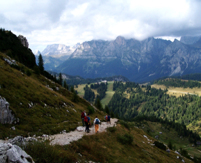
Cycling is a great way to enjoy these mountains, but if you're curious, you'll want to know what lies beyond the roads. It's time to grab your boots and backpack and head for the superb network of trails maintained and marked by C.A.I., the Italian Alpine Club, and other entities, Hiking trails in the Dolomites are easy to find and follow. The best known are the multi-day Alta Via routes that criss-cross the range. The websites of Individual areas (click the logos on the bottom of this page) offer a wealth of information, such as this fascinating excursion. There's no need to pack a tent, sleeping (a sleeping bag liner, yes), meals, and stove, for wherever you go, you'll find abundant rifugi (refuges) offering bunks and hearty meals prepared by the hutkeeper (this is Italy, after all!). The excellent Tabacco topo maps (1:25,000) can be purchased in bookstores and newspaper/magazine stores.
Do not rely on social media and influencers for information and advice! Alpine rescue personnel are frequenly called out to rescue clueless, inexperienced, unequipped, and unprepared hikers who choose to go on hikes based on nothing more than the beautiful photos and cursory descriptions of bloggers and wanna-be social media stars (who may not have even been there themselves).
PLAN AHEAD AND PREPARE!
• There is no such thing as a short, easy, hike. That kind of thinking causes people to not take a hike seriously, and to set out unprepared. Unexpected happenings, even seemingly banal routes, can turn things around very quickly and have serious consequences.
• Familiarize yourself with the route you're going to take.
• Download the offline map of your route to your phone. Always bring a power bank, both for phone navigation (it's best to put your phone in flight safe mode so it doesn't waste power looking for wi-fi networks), and for calling rescue services. Be aware, however, that there is not always coverage. Bring a compass and map as well (and know how to use them!).
• Download the GeoResQ app.
• Don't overestimate your own ability and capacity, and be cognizant of the fact that trail ratings are relative: what is easy for one person can turn into an impossible, perilous, ordeal for another. Some hikers need to be rescued simply because they are too exhausted to continue, others because they go off the trail and find themselves lost, still others find the trail blocked by a landslide or snow and ice, or wind up in an impervious spot, and others because they are not prepared for changes in weather and temperature.
• Wear hiking boots or sturdy trail shoes with a deeply lugged and grippy sole, not sneakers/trainers--(nor sandals or flip flops! --this shouldn't need to be said, but hikers have actually been seen--and rescued--wearing such footwear!)
• Long hiking pants of a breatheable fabric are preferable to shorts. Absolutely no jeans! Cotton t-shirts absorb sweat, get soggy, and chill your body if the temperature.drops. Lightweight wool or synthetic shirts are the way to go. Synthetics dry quickly, and wool will keep you warm even when it's wet. (You wouldn't go cycling in a cotton t-shirt, right?)
• Always take: food, energy snacks, plenty of water, a warm layer or two, and a waterproof, breathable, parka or jacket. Other essentials include a small first aid kit, insect repellant and bite treatment, sunscreen, cap/bandanna/Buff, and a head lamp. A painkiller (tablets or gel), antihisamine (tablets and/or creme), and a whistle and signal mirror are a good idea as well.
• If you use trekking poles (highly recommended), know how to use them properly and efficiently.
• Always check the local weather report
• Start out in the morning: storms often arrive later in the day, If something goes awry, you don't want to be caught out in the darkness.
• NEVER HIKE ALONE; and leave word where you are going. Better yet, join a guided excursion.
• NEVER LEAVE THE TRAIL! Don't take shortcuts unless they are clearly marked as such.
• Leave what you find intact, be it flowers, berries, mushrooms, fossils, etc., and do not disturb wildlife, herds of cows (which can be dangerous!); give flocks of sheep a wide berth, as they may be guarded by dogs bred to defend to defend them from all intruders,..including you!
• Enjoy the sounds of nature; do not cover them up by talking loudly, or worse, listening to music with earbuds.
• Carry out trash and waste


Street view? No, trail view! You can do virtual hikes in the UNESCO Dolomites, thanks to Google Maps. Click here to see the areas available for exploration. You can click each area (Pelmo, Pale di San Martino, Sciliar etc), then choose one of the routes on the right and click "View on Google Maps" in the the upper left of the window. Expand the section with pegman on the lower left to orient yourself and get an overview of the area. Just click on the trail (or pegman) and away you go. I have mixed feelings about "virtual hiking" but it does offer advantages: it enables hikers to preview trails to determine if they are suitable for their cababilities, and lets those who have hiked them relive their experiences (I enjoy doing that myself). Finally, it permits those who are physically (or otherwise) unable to hike them, to see places they would never have been able to see.
Hiking in the Dolomites
In Progress!